Every quotation starts from a site, and the site's plot area is what the estimator reads to suggest quantities. This guide shows how to record a site with its customer, plot size and location, keep it up to date, and remove one you no longer need.
Who it is forEstimator or project coordinatorTime12 minutesProductBuildFlowLevelBeginner
Before you start
Steps
1
Open Sites and add a site
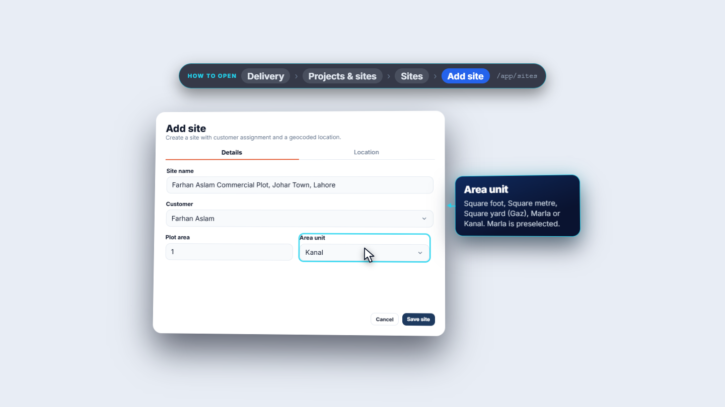
Go to Delivery › Projects & sites › Sites (/app/sites). The list shows each site's name, customer, address, plot area and coordinates, and a site with no coordinates yet shows a dash. The row menu on the right offers View, Edit and Delete. Click Add site. A side sheet opens with two tabs, Details and Location. Fill in Site name (required), here Farhan Aslam Commercial Plot, Johar Town, Lahore. Pick the Customer: typing filters the list, and No customer is allowed too. Enter the Plot area (1) and the Area unit: Square foot, Square metre, Square yard (Gaz), Marla or Kanal. Marla is the default, here we choose Kanal.
Add site sheet with name, customer, plot area and unit
2
Set the location and save
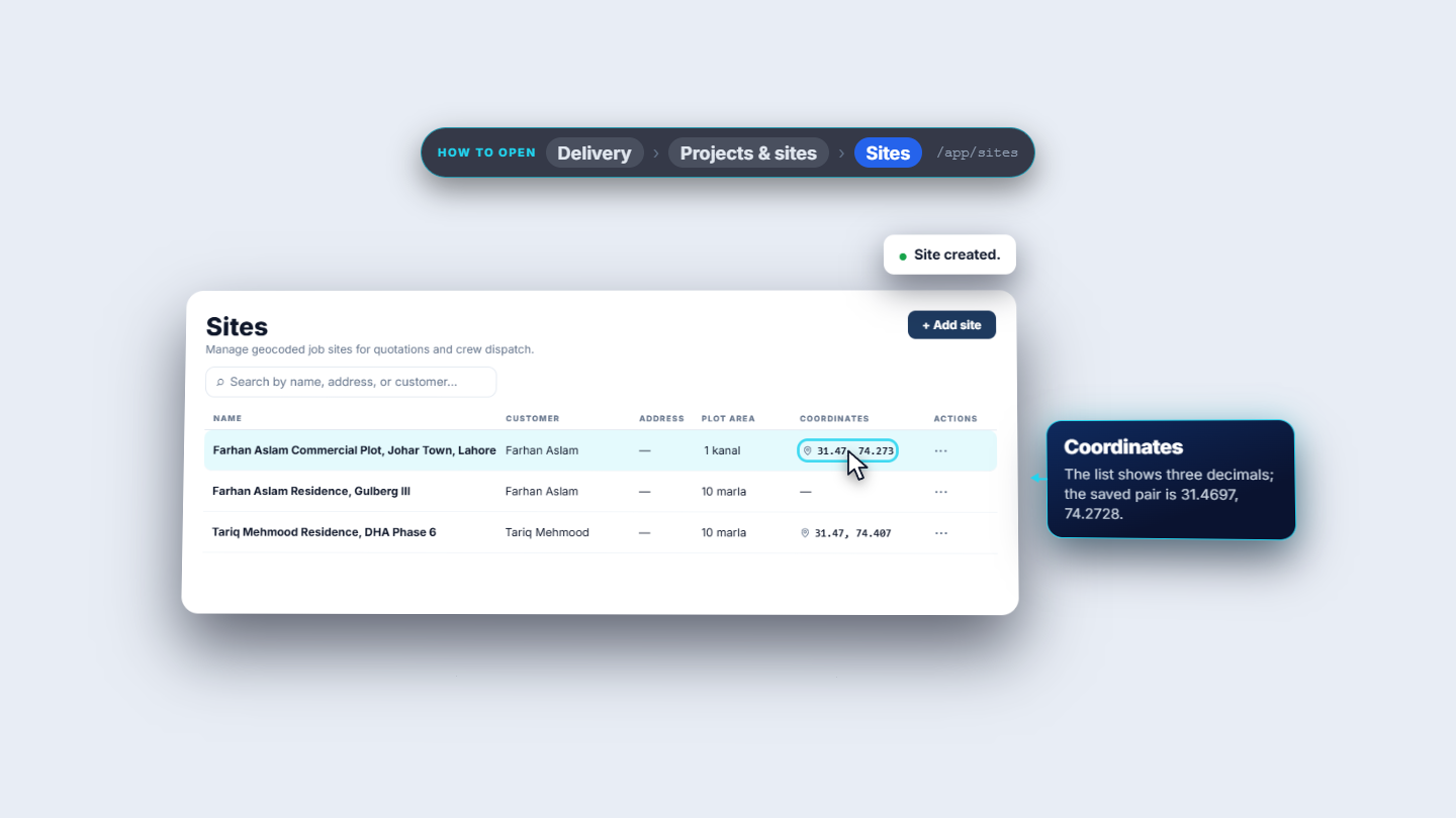
Open the Location tab. It says Maps preview unavailable when your workspace has no browser map key, so address search is off. Tick Use manual coordinates and type a Latitude and a Longitude. With only a latitude, Save site is refused (Enter both latitude and longitude.). A longitude of 200 is refused too (Latitude or longitude is out of range.). A valid pair, 31.4697 and 74.2728, is accepted. Click Save site. The toast says Site created. and the new site is the top row: 1 kanal, with the coordinates shown as 31.47, 74.273.
Sites list after Site created, with the new row and its coordinates
3
View, edit and search
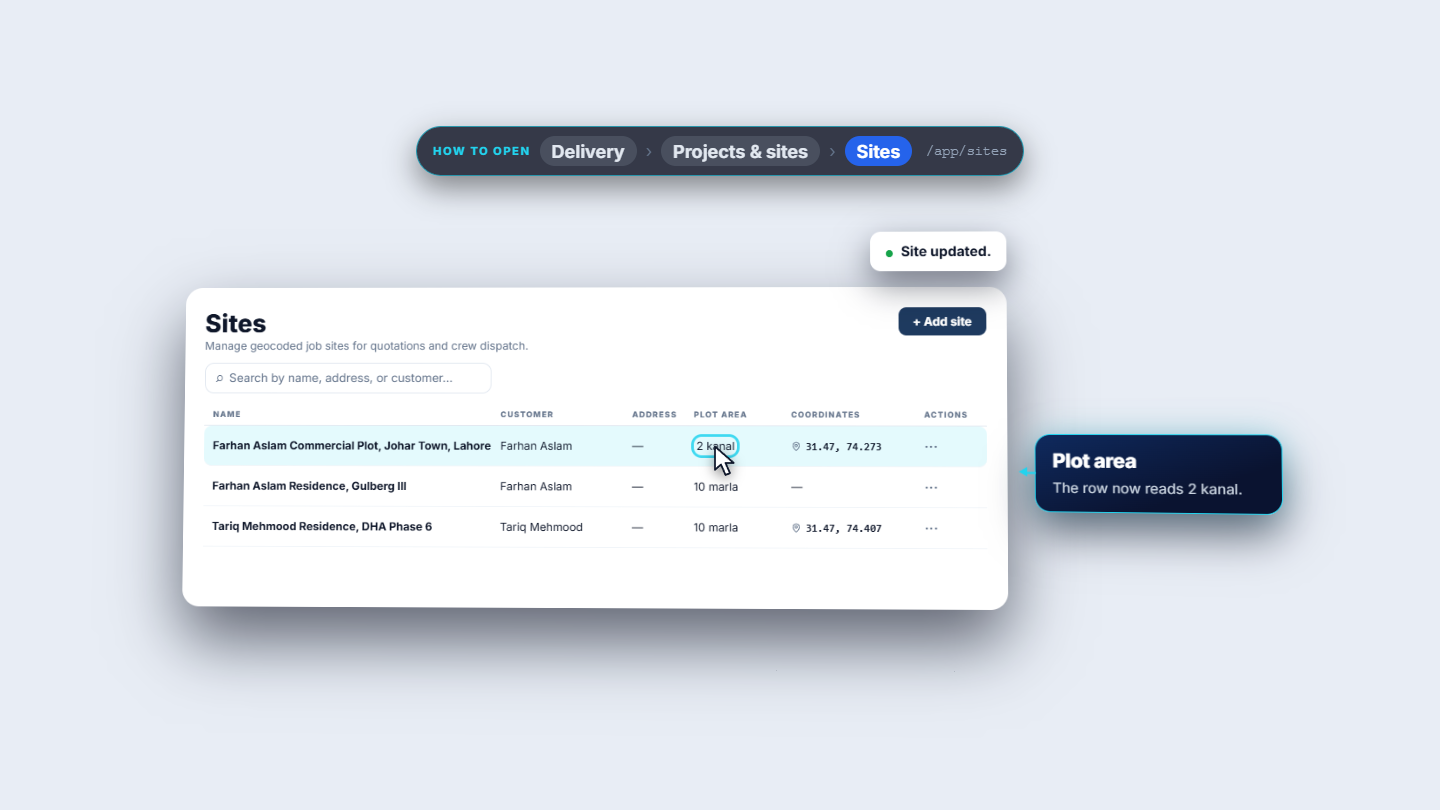
Choose View to open Site details: the name, customer, plot area, and when the record was created and last updated. The Location tab shows the coordinates on a map card and a Directions button that opens Google Maps. Choose Edit to change a field. Here the plot area changes from 1 to 2 kanal. Save site shows Site updated. and the row reads 2 kanal. The search box filters by name, address or customer. Typing "Johar" finds the one site. A search with no match says No matching sites, and clearing the search brings the list back.
Sites list after editing the plot area to 2 kanal
4
See where the site is used
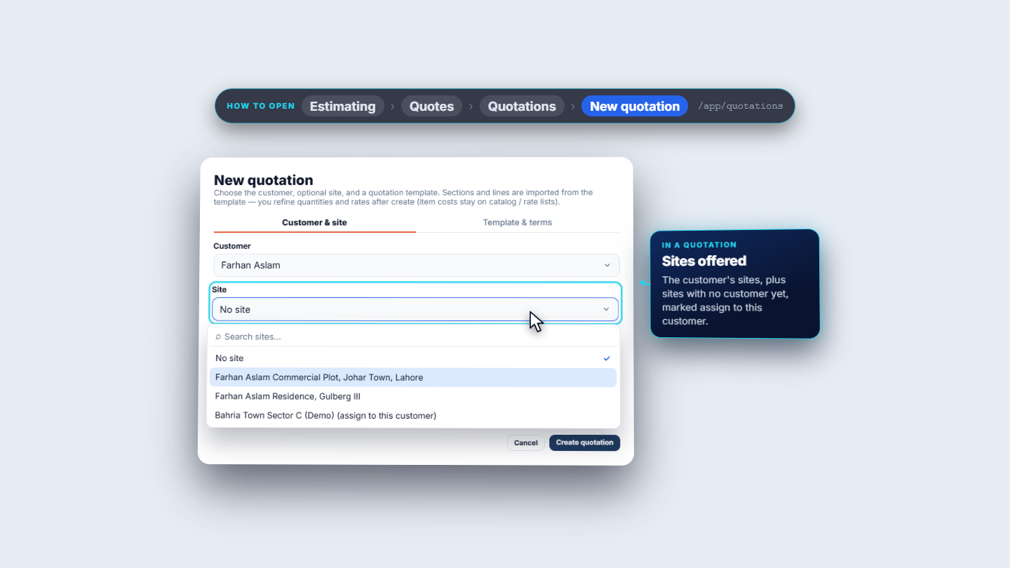
When you start a quotation (Estimating › Quotes › Quotations › New quotation), choosing a customer fills the Site list with that customer's sites. The new site is there. Sites that belong to nobody yet are offered too, marked assign to this customer, for example Bahria Town Sector C (Demo). The site's plot area is what the estimator reads. In Admin › Settings › Estimating, Plot package quantities has one column per plot size. In the Grey Structure template the Rebar 10 mm line is 3,143 for a 10 marla plot and 6,286 for 1 kanal, which is 20 marla. These recommendations stay advisory until you apply them.
Site list in New quotation showing the customer's sites
5
Delete a site you no longer need
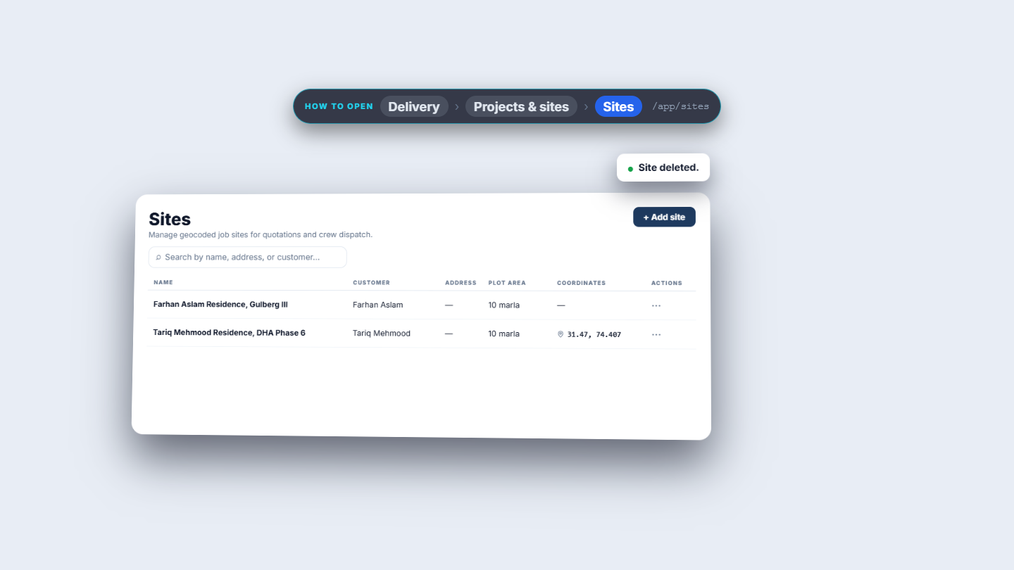
Choose Delete on the row. The app asks Delete site? and explains that it soft-deletes the site, and that project and history relations are preserved. Click Delete site. The toast says Site deleted. and the row leaves the list.
Sites list after Site deleted
Check it worked
The new site is at the top of Sites with its plot area and a coordinate pair.
After an edit, the row shows the new plot area (2 kanal).
The customer's site appears in the Site list of New quotation.
Common mistakes
Mistake
What you see
Fix
Entering only a latitude or only a longitude
Enter both latitude and longitude.
Type both values
Longitude outside the valid range
Latitude or longitude is out of range.
Re-enter a valid pair
Plot area saved with the wrong number or unit
The row shows the wrong size, for example 1 kanal instead of 2
Choose Edit and correct the plot area
Quoting before a site exists
The quotation cannot be sent or approved
Add the site first
Quick reference
Item
Meaning / rule
Plot area and unit
Size of the plot; the estimator reads it
Manual coordinates
Type latitude and longitude when no map key is set
Directions
Opens Google Maps for the saved coordinates
Delete
Soft delete; project and history relations are kept
Frequently asked questions
Why does the estimator need the plot area of a site? The site's plot area, a number and a unit such as 1 kanal, is what the estimator reads, and the plot package quantities in the Estimating settings have one column per plot size. The recommendations stay advisory until you apply them.
What do I do if my workspace has no map key? The Location tab says Maps preview unavailable and address search is off. Tick Use manual coordinates and type a latitude and a longitude; both are required.
Does deleting a site remove its projects and history? No. The app soft-deletes the site and says that project and history relations are preserved.